


Waymo Mapping Technology Explained: How Cars Know Their Location
Self-driving cars look like magic. They stop at lights turn at intersections. They avoid people crossing the street. But they are not guessing. They use maps. Waymo mapping technology explained simply means creating a super detailed digital map of city roads.
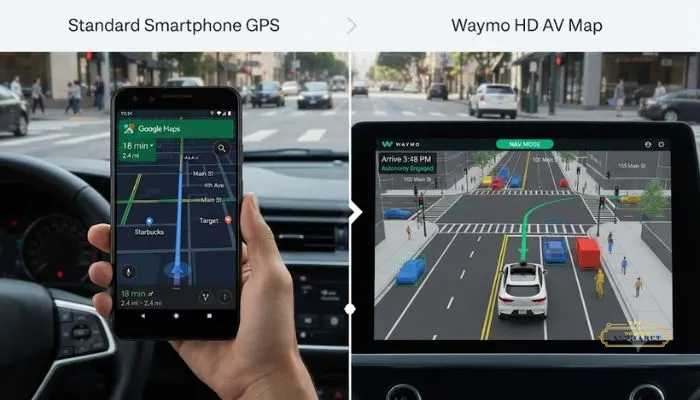
These maps are not like Google Maps. They include lane lines, curb heights, traffic light positions, and stop signs. Waymo builds these maps before driving in a new city. The car matches what it sees with the map. This helps it know exactly where it is. This article covers how Waymo makes these maps and why they matter.
What Is Waymo Mapping?
Waymo mapping means creating custom, highly detailed maps for autonomous vehicles. These maps are like memory for the car . They give the vehicle important context about every location it drives.
The maps include information that regular GPS maps do not have:
- The exact height of curbs
- The width of intersections
- The precise location of traffic lights
- Where stop signs are placed
- Lane merges and crosswalks
- Speed limits on every road
These maps are updated regularly to reflect changes like construction zones or road closures.
Read More: Waymo Safety System: How Self-Driving Cars Prevent Crashes
The Waymo Mapping Process
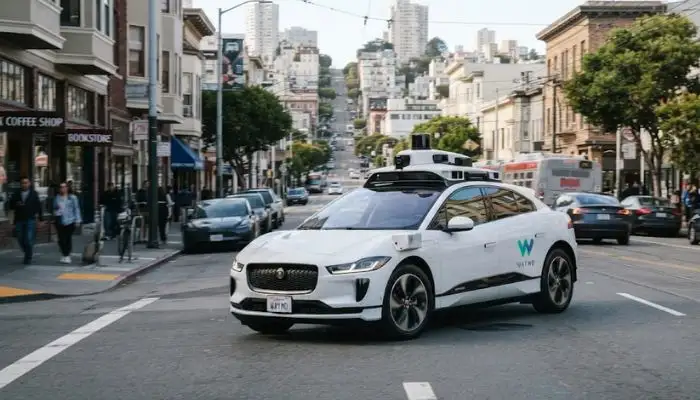
Here is how Waymo builds these maps for a new location .
Step 1: Drive the Streets
The process starts with a person manually driving a sensor-equipped vehicle down every street in the area .
Step 2: Paint a 3D Picture
The vehicle's sensors, especially its lidar system, collect data. The lasers send out pulses of light that bounce back, creating a detailed 3D image of the environment .
Step 3: Process the Data
The raw data is processed to add useful context. This includes things like speed limits, lane lines, traffic signals, and information for the Driver's software .
Step 4: Verify and Deploy
Before a new map is shared with the fleet, the team tests and verifies it to ensure it is accurate and ready for the vehicles to use .
How the Waymo Driver Uses Its Map?
The map works like a memory for the Waymo Driver . The vehicle matches what it sees in real-time with the map it already has. This allows the car to know its exact position on the road to within 10 centimeters of accuracy, even in places where GPS struggles, like tunnels .
Knowing the permanent features of the road is a huge advantage. The Waymo Driver's sensors and software can focus more on moving objects, like pedestrians, cyclists, and other vehicles .
For example, when the Waymo Driver approaches an intersection, its map tells it that a car approaching from the side has a stop sign. The sensors then detect if that car is going too fast and respond quickly .
Why Are These Maps So Important?
The maps give the Waymo Driver a deep understanding of its environment. This allows the car to drive smoother and more predictably.
Better Positioning
With custom maps, the Waymo Driver knows its position on the road to within 10 centimetres of accuracy . It does not rely on GPS, which can be unreliable in tunnels or between tall buildings.
Focus on Moving Objects
The car already knows permanent features of the road from its maps. This means its sensors and software can focus more on moving objects like pedestrians, cyclists, and other vehicles .
Predicting Behavior
When the Waymo Driver approaches an intersection, it knows that a car crossing its path has a stop sign . If the car is going too fast, the Waymo Driver can respond quickly.
What Does Waymo Stand For?
Waymo stands for "A New Way Forward in Mobility." The name comes from "Way" and "Mobility" combined. It was originally the Google self-driving car project before becoming an independent company within Alphabet.
Do Waymo Cars Have Drivers?
No, Waymo cars do not have human drivers in the traditional sense. Waymo operates at Level 4 automation under the SAE framework . This means the system can fully handle the driving task without human input within defined conditions and locations .
However, there are remote operators who can assist if the car gets confused . These operators do not drive the cars remotely most of the time. But when the vehicle encounters a situation it cannot handle, it can ping a human for instructions .
You May Also Read: Waymo 2026 Market Expansion Atlanta Austin: Maps and Prices
How Do Waymo Cars Stay Updated?
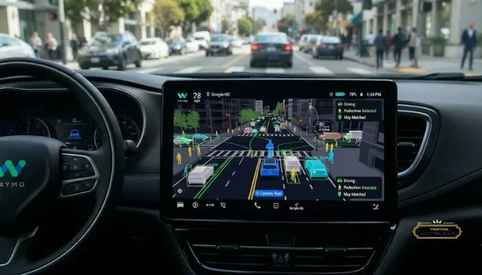
Streets change. Construction happens. New traffic signs appear. Waymo cars automatically send reports back to the mapping team whenever they detect changes . The team can then update the map and share the information with the whole fleet.
The Bottom Line
Waymo mapping technology is not like the maps on your phone. It is a custom, highly detailed blueprint of the road environment created using sensors and manual annotation. These maps give self-driving cars context they need to navigate safely. Combined with real-time sensor data and AI, they allow Waymo to operate fully autonomous vehicles in multiple cities.
FAQs
1. What is Waymo mapping?
Waymo mapping is building a super detailed digital map of city roads. It includes lane lines, curb heights, traffic lights, and stop signs. Much more detailed than phone maps.
2. How does Waymo make its maps?
They drive special cars with sensors down every street. Lidar creates a 3D picture. Then they add details like speed limits and traffic signals. They test everything before using it.
3. Do Waymo cars have drivers?
No. They are fully self-driving. Level 4 autonomy. No one sits behind the wheel. The system drives itself.
4. What does Waymo stand for?
"A new way forward in mobility." That is the meaning behind the name.
5. How does the car use its map?
The map is like a memory. The car matches what it sees with the map. This helps it know exactly where it is, even in tunnels where GPS fails.
6. Why not just use Google Maps?
Google Maps is for finding directions. Waymo maps are for driving. They show exact lane positions, curbs, and traffic lights. Google Maps is not detailed enough.
7. How long to map a new city?
Months. They drive every street, process huge amounts of data, and verify everything. That is why Waymo expands slowly.
8. Does Waymo update its maps?
Yes. Roads change. Construction happens. They update regularly. Cars also report changes they spot while driving.
9. Does Waymo map private roads?
No. Only public roads where their cars are allowed to drive. Private driveways are not included.
10. Is Waymo the only one doing this?
No. Cruise and Zoox do it too. But Waymo has been doing it longest and has mapped thousands of miles across multiple U.S. cities.